卷四·第 210–213 问 有人居住的四分之一、诸海与赤道线
地理卷开篇:人只住在北方的一个四分之一,诸海如何环绕它,赤道线经过哪里、有何性质,以及人为何头都朝天。
BOOK IV. GEOGRAPHY
§210. How is the inhabited world situated?
The plane of the equator cuts the earth in two halves along a circle called the equinoctial line (khaṭṭ al-istiwāʾ), so that one of its halves is northern and the other southern. If you imagine a great circle on the earth passing through the poles of the equinoctial line, it divides each of the two halves of the earth in two, and so the whole is divided into quarters, two southern and two northern. Habitation, as those who have concerned themselves with it have found it, does not go beyond one of the two northern quarters; so this is called the inhabited or dwelt-in quarter, standing out like an island surrounded by the seas. This quarter in itself contains the known seas, islands, mountains, rivers and deserts that are known and travelled, and then the countries and villages between them; except that there remains of it, towards the north pole, a piece that is uninhabited because of the excessive cold and the piling up of snow.
翻译点开
BOOK IV. GEOGRAPHY
卷四 地理
§210. How is the inhabited world situated?
第二百一十问 有人居住的世界是怎样安置的?
The plane of the equator cuts the earth in two halves along a circle called the equinoctial line (khaṭṭ al-istiwāʾ), so that one of its halves is northern and the other southern. If you imagine a great circle on the earth passing through the poles of the equinoctial line, it divides each of the two halves of the earth in two, and so the whole is divided into quarters, two southern and two northern. Habitation, as those who have concerned themselves with it have found it, does not go beyond one of the two northern quarters; so this is called the inhabited or dwelt-in quarter, standing out like an island surrounded by the seas. This quarter in itself contains the known seas, islands, mountains, rivers and deserts that are known and travelled, and then the countries and villages between them; except that there remains of it, towards the north pole, a piece that is uninhabited because of the excessive cold and the piling up of snow.
天赤道的平面沿着一个圆把地球切成两半,这个圆称为赤道线,于是地球的一半在北,另一半在南。若你设想地上有一个大圆通过赤道线的两极,它就把地球的两半各分为二,于是全体被分成四份,两份在南,两份在北。就致力于此事的人所发现的而言,人的居住不超出两个北方四分之一中的一个;所以这一份称为有人居住的四分之一,或有人栖居的四分之一,它像一座被诸海环绕的岛屿那样突出。这个四分之一本身包含已知的海、岛、山、河与荒漠,都是人所知道、有人往来的,以及其间的国家与村落;只是它朝北极的方向还留有一片无人居住,那是因为严寒和积雪堆叠。
大意与图解点开
🔎 大意:赤道线分地为南北,过两极的大圆再各分为二,成四份;人的居住只在北方的一份里,像海中一岛,近北极处因严寒无人。
📖 术语
| 术语 | 英文原词 | 意思 |
|---|---|---|
| 赤道线 | khaṭṭ al-istiwāʾ | 地上的赤道 |
| 有人居住的四分之一 | the inhabited quarter | 人所居住的那一份 |
| 天赤道 | the equator | 天球上的赤道 |
| 居住 | habitation | 有人定居之处 |
🧭 图解与讲解
卷四讲地理。比鲁尼从地球的分法讲起:天赤道的平面切过地球,在地面上留下一个圆,就是“赤道线”(khaṭṭ al-istiwāʾ,本义“平齐之线”),把地球分成南北两半。再设想一个大圆通过赤道线的两极,又把南北两半各分为二。于是地球分成四份:两份在南,两份在北(图一)。
〔图〕赤道线分南北,过两极的大圆再分前后;人只住在北方两个四分之一中的一个
〔图〕两次一分为二:先以赤道线分南北,再以过两极的大圆分东西,人居只占其一
人的居住只在北方两份中的一份里,所以称为“有人居住的四分之一”。它四面被海包围,像一座大岛。这块地方里有已知的海、岛、山、河、荒漠,有人往来,有国家与村落;只在靠近北极的一角,严寒积雪,无人能住(图二)。比鲁尼说的是“就致力于此事的人所发现的而言”,即以当时所知为限。
这一分法直接关系到占星的计算。下文的城市纬度从赤道线往北量,经度从有人居住之地的西端往东量;后面讲各地昼夜长短、星座上升时间、宫位的划分,都要先知道一个城市在这块“岛”上的什么位置。
📖 术语
| 术语 | 英文原词 | 意思 |
|---|---|---|
| 赤道线 | khaṭṭ al-istiwāʾ | 地上的赤道 |
| 有人居住的四分之一 | the inhabited quarter | 人所居住的那一份 |
| 天赤道 | the equator | 天球上的赤道 |
| 居住 | habitation | 有人定居之处 |
🧭 图解与讲解
卷四讲地理。比鲁尼从地球的分法讲起:天赤道的平面切过地球,在地面上留下一个圆,就是“赤道线”(khaṭṭ al-istiwāʾ,本义“平齐之线”),把地球分成南北两半。再设想一个大圆通过赤道线的两极,又把南北两半各分为二。于是地球分成四份:两份在南,两份在北(图一)。
人的居住只在北方两份中的一份里,所以称为“有人居住的四分之一”。它四面被海包围,像一座大岛。这块地方里有已知的海、岛、山、河、荒漠,有人往来,有国家与村落;只在靠近北极的一角,严寒积雪,无人能住(图二)。比鲁尼说的是“就致力于此事的人所发现的而言”,即以当时所知为限。
这一分法直接关系到占星的计算。下文的城市纬度从赤道线往北量,经度从有人居住之地的西端往东量;后面讲各地昼夜长短、星座上升时间、宫位的划分,都要先知道一个城市在这块“岛”上的什么位置。
§211. How are the seas situated in the inhabited world?
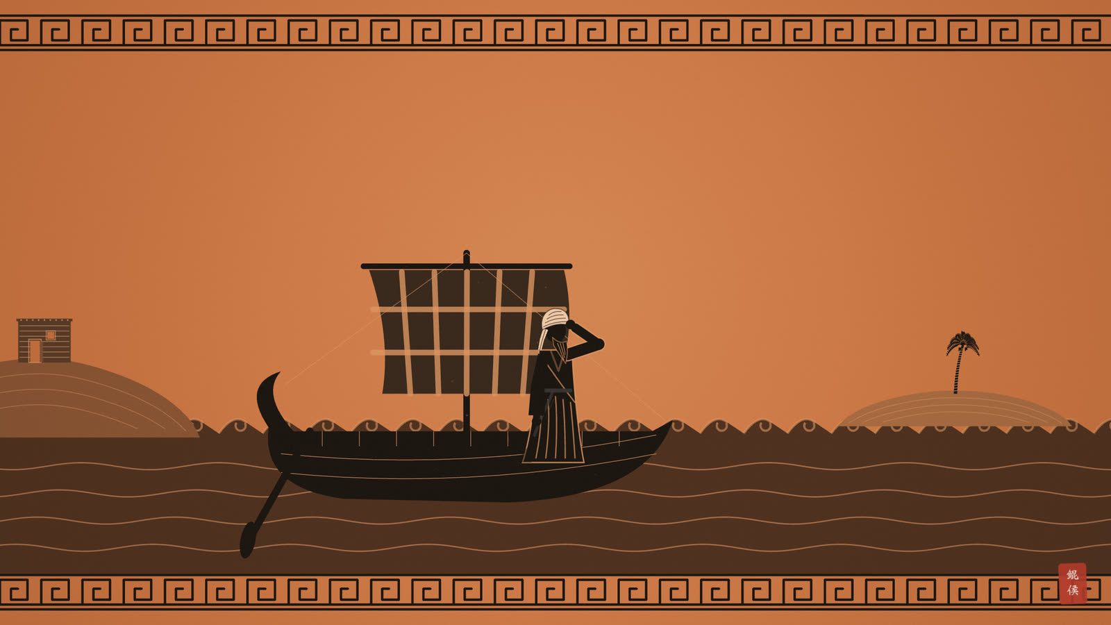
The sea in the west of the inhabited world, on whose shore lie the lands of Ṭanja and al-Andalus, is called the Encircling Sea (al-baḥr al-muḥīṭ), and the Greeks call it Ōqiyānūs (Ocean). Ships do not go out into its deep waters but travel only near its shore. From these lands it stretches northward alongside the land of the Ṣaqāliba (Slavs), and a great gulf goes out from it to the north of the Ṣaqāliba and stretches to near the land of the Muslim Bulghār. They know it as the Sea of the Warank, who are a nation on its shore; then it turns behind them towards the east. Between its shore and the farthest land of the Turks there are lands and mountains that are unknown, desolate and untravelled. As for the extension of the western Encircling Sea from the land of Ṭanja towards the south, it turns along the south of the land of the Sūdān of the West, behind the mountains known as the mountains of the Moon, from which the springs of the Nile of Egypt rise; to travel on it is perilous, and no ship comes out of it safe. The Encircling Sea on the side of the east, beyond the farthest parts of the land of Ṣīn (China), is likewise not travelled. From it branches a gulf from which comes the sea that is named in every place after the land facing it: so it is first the Sea of Ṣīn, then of Hind. From it go out great gulfs, each of which is called a sea on its own, such as the Sea of Fārs and of Baṣra, on whose eastern side is Tīz of Makrān, and on whose western side, opposite it, the port of ʿUmān. When it passes this, it reaches the land of al-Shiḥr, from which frankincense is brought, and passes on to ʿAdan (Aden). There two great gulfs branch off from it. One is the one known as al-Qulzum, which bends round and surrounds the land of the Arabs, so that it makes it like an island; and because al-Ḥabasha (Abyssinia) lies on it opposite al-Yaman, it is named after the two of them. It became known as al-Qulzum only because that is a city at its end in the land of al-Shām, where it narrows, and around which one who travels along the shore turns towards the land of the Bujja. The other gulf is the one known as the Sea of Barbarā. Then the main body of the sea stretches as far as Sufāla of the Zanj, beyond which no ship goes because of the great danger in it that we have mentioned; and after it, it joins the western Ocean. In this sea, in the regions of the east, are the islands of al-Zābaj, then the islands of al-Dībajāt and Qumayr, then the islands of the Zanj; among the greatest of them is the one known as Sarandīb, in Indian Sankaladīb, from which the kinds of ruby come and are brought. From Kalah the qalʿī lead (tin) is brought, and from Sarbuza camphor is brought. Then in the middle of the inhabited world, in the land of the Ṣaqāliba and the Rūs, there is a sea known among the Greeks as Pontus and among us as the Sea of Ṭarābazunda, because that is a port on it. A gulf goes out from it along the wall of Constantinople, and it keeps narrowing until it falls into the Sea of al-Shām, on whose south lie the lands of the West as far as Alexandria and Egypt, and opposite them in the north the land of al-Andalus and of the Rūm as far as Antioch, with the lands of al-Shām and Filasṭīn between them. It pours into the Encircling Sea at al-Andalus through a strait mentioned in the books as the Crossing of Heracles and known now as al-Zuqāq ('the Lane'), through which its water runs into the Encircling Sea. Among the known islands in it are Cyprus, Samos, Rhodes, Sicily and the like. Near Ṭabaristān there is a sea, that of Jurjān, on which lies the city of Ābaskūn, after which it is named. It then stretches to Ṭabaristān, the land of al-Daylam, Shirwān, Bāb al-Abwāb and the region of the Alān, then to the Khazars at the mouth of the river Itil into it, then to the dwellings of the Ghuzz, until it comes back to Ābaskūn. It is sometimes named after each tract it faces, but among us it is best known by the Khazars and among the ancients by Jurjān, for Ptolemy calls it the Sea of Hyrcania (Arqāniyā). It is not connected with any other sea. As for the other waters gathered in places on the earth, they are swamps and marshes, sometimes called lakes, like the lakes of Afāmiya (Apamea), Ṭabariyya (Tiberias) and Zughar in the land of al-Shām, the lake of Khwārazm, and Īsīkūl near Barskhān. This is the figure of what we have mentioned, approximately.
翻译点开
§211. How are the seas situated in the inhabited world?
第二百一十一问 诸海在有人居住的世界中是怎样安置的?
The sea in the west of the inhabited world, on whose shore lie the lands of Ṭanja and al-Andalus, is called the Encircling Sea (al-baḥr al-muḥīṭ), and the Greeks call it Ōqiyānūs (Ocean). Ships do not go out into its deep waters but travel only near its shore. From these lands it stretches northward alongside the land of the Ṣaqāliba (Slavs), and a great gulf goes out from it to the north of the Ṣaqāliba and stretches to near the land of the Muslim Bulghār. They know it as the Sea of the Warank, who are a nation on its shore; then it turns behind them towards the east. Between its shore and the farthest land of the Turks there are lands and mountains that are unknown, desolate and untravelled. As for the extension of the western Encircling Sea from the land of Ṭanja towards the south, it turns along the south of the land of the Sūdān of the West, behind the mountains known as the mountains of the Moon, from which the springs of the Nile of Egypt rise; to travel on it is perilous, and no ship comes out of it safe. The Encircling Sea on the side of the east, beyond the farthest parts of the land of Ṣīn (China), is likewise not travelled. From it branches a gulf from which comes the sea that is named in every place after the land facing it: so it is first the Sea of Ṣīn, then of Hind. From it go out great gulfs, each of which is called a sea on its own, such as the Sea of Fārs and of Baṣra, on whose eastern side is Tīz of Makrān, and on whose western side, opposite it, the port of ʿUmān. When it passes this, it reaches the land of al-Shiḥr, from which frankincense is brought, and passes on to ʿAdan (Aden). There two great gulfs branch off from it. One is the one known as al-Qulzum, which bends round and surrounds the land of the Arabs, so that it makes it like an island; and because al-Ḥabasha (Abyssinia) lies on it opposite al-Yaman, it is named after the two of them. It became known as al-Qulzum only because that is a city at its end in the land of al-Shām, where it narrows, and around which one who travels along the shore turns towards the land of the Bujja. The other gulf is the one known as the Sea of Barbarā. Then the main body of the sea stretches as far as Sufāla of the Zanj, beyond which no ship goes because of the great danger in it that we have mentioned; and after it, it joins the western Ocean. In this sea, in the regions of the east, are the islands of al-Zābaj, then the islands of al-Dībajāt and Qumayr, then the islands of the Zanj; among the greatest of them is the one known as Sarandīb, in Indian Sankaladīb, from which the kinds of ruby come and are brought. From Kalah the qalʿī lead (tin) is brought, and from Sarbuza camphor is brought. Then in the middle of the inhabited world, in the land of the Ṣaqāliba and the Rūs, there is a sea known among the Greeks as Pontus and among us as the Sea of Ṭarābazunda, because that is a port on it. A gulf goes out from it along the wall of Constantinople, and it keeps narrowing until it falls into the Sea of al-Shām, on whose south lie the lands of the West as far as Alexandria and Egypt, and opposite them in the north the land of al-Andalus and of the Rūm as far as Antioch, with the lands of al-Shām and Filasṭīn between them. It pours into the Encircling Sea at al-Andalus through a strait mentioned in the books as the Crossing of Heracles and known now as al-Zuqāq ('the Lane'), through which its water runs into the Encircling Sea. Among the known islands in it are Cyprus, Samos, Rhodes, Sicily and the like. Near Ṭabaristān there is a sea, that of Jurjān, on which lies the city of Ābaskūn, after which it is named. It then stretches to Ṭabaristān, the land of al-Daylam, Shirwān, Bāb al-Abwāb and the region of the Alān, then to the Khazars at the mouth of the river Itil into it, then to the dwellings of the Ghuzz, until it comes back to Ābaskūn. It is sometimes named after each tract it faces, but among us it is best known by the Khazars and among the ancients by Jurjān, for Ptolemy calls it the Sea of Hyrcania (Arqāniyā). It is not connected with any other sea. As for the other waters gathered in places on the earth, they are swamps and marshes, sometimes called lakes, like the lakes of Afāmiya (Apamea), Ṭabariyya (Tiberias) and Zughar in the land of al-Shām, the lake of Khwārazm, and Īsīkūl near Barskhān. This is the figure of what we have mentioned, approximately.
有人居住的世界西边的海,丹吉尔和安达卢斯诸地就在它的岸边,称为环海,希腊人称之为“奥基亚努斯”,即大洋。船只不驶入它的深处,只在近岸处航行。它从这些地方沿着斯拉夫人之地向北延伸,从它分出一个大海湾,伸到斯拉夫人之北,一直延伸到穆斯林保加尔人之地附近。人们称它为瓦兰克海,瓦兰克是住在它岸边的一个民族;然后它在他们背后转向东方。在它的岸边与突厥人最远之地之间,有一些不为人知、荒凉而无人往来的土地和山岭。至于西方的环海从丹吉尔之地向南的延伸,它沿着西方苏丹之地的南边转过去,在那些称为月亮山的山脉背后,埃及尼罗河的源泉就从那些山中涌出;在它上面航行是危险的,没有船能平安从中出来。东方一侧的环海,在中国之地的最远处以外,同样无人往来。从它分出一个海湾,由此形成的海在每一处都以面对它的土地命名:先是中国海,然后是印度海。从它又分出几个大海湾,每一个都单独称为一海,例如法尔斯海和巴士拉海,它的东岸是莫克兰的提兹,西岸与之相对的是阿曼的港口。过了这里,它到达席赫尔之地,乳香就从那里运来,再往前到达亚丁。在那里,从它分出两个大海湾。一个是称为古勒祖姆的那个,它弯转过来环绕阿拉伯人之地,使之如同一座岛屿;又因为阿比西尼亚在它的岸上与也门相对,所以它也以二者命名。它之所以称为古勒祖姆,只是因为那是它尽头处沙姆之地的一座城,海在那里变窄,沿岸而行的人绕过它便转向布贾人之地。另一个海湾是称为柏培拉海的那个。然后大海的主体一直伸展到僧祇的索法拉,由于我们所说的那种巨大危险,没有船越过那里;在那之后,它与西方的大洋相接。在这片海中,在东方诸地,有扎巴吉诸岛,然后是迪巴贾特诸岛和古迈尔诸岛,然后是僧祇诸岛;其中最大的之一是称为锡兰迪布的那个,印度语称僧伽罗迪布,各种红宝石就从那里出产运来。从箇罗运来箇罗铅,即锡;从萨尔布扎运来樟脑。然后在有人居住的世界中部,在斯拉夫人与罗斯人之地,有一个海,希腊人称为本都,我们称为特拉布宗海,因为特拉布宗是它岸上的一个港口。从它分出一个海湾,沿着君士坦丁堡的城墙而行,越来越窄,直到注入沙姆海;沙姆海的南边是西方诸地,一直到亚历山大和埃及,北边与之相对的是安达卢斯和罗姆之地,一直到安条克,沙姆和巴勒斯坦诸地在二者之间。它在安达卢斯经一条海峡注入环海,这海峡在书中称为赫拉克勒斯的渡口,如今称为“巷”,它的水就经此流入环海。其中已知的岛屿有塞浦路斯、萨摩斯、罗得、西西里之类。在塔巴里斯坦附近有一个海,就是朱尔将海,阿巴斯昆城在它岸上,它也以此城命名。它接着伸展到塔巴里斯坦、德拉姆之地、希尔万、众门之门和阿兰地区,然后到可萨人那里,伊提尔河在那里注入它,然后到古兹人的住地,直到回到阿巴斯昆。它有时以它所面对的每一片地方命名,但在我们这里最常以可萨人称之,在古人那里则以朱尔将称之,因为托勒密称它为希尔卡尼亚海。它不与任何别的海相连。至于地上别处汇聚的水,它们是沼泽和泽地,有时称为湖,如沙姆之地的阿帕米亚湖、太巴列湖和祖加尔湖,花剌子模湖,以及拔塞干附近的伊塞克湖。这就是我们所述的图,只是大概而已。
大意与图解点开
🔎 大意:西方与东方的环海包围人居之地;东方之海分出中国海、印度海、波斯湾与红海诸湾,中部有黑海、地中海,里海独立不通。
📖 术语
| 术语 | 英文原词 | 意思 |
|---|---|---|
| 环海 | al-baḥr al-muḥīṭ | 包围人居之地的大洋 |
| 奥基亚努斯 | Ōqiyānūs | 希腊语的大洋 |
| 古勒祖姆 | al-Qulzum | 红海,因城得名 |
| 巷 | al-Zuqāq ('the Lane') | 地中海通大洋的海峡 |
| 朱尔将海 | the Sea of Jurjān | 里海,又称可萨海 |
🧭 图解与讲解
这一问是一幅文字的海图。比鲁尼从西边说起:有人居住之地的西边是“环海”,希腊人称“奥基亚努斯”(Ōqiyānūs),丹吉尔(Ṭanja)与安达卢斯(al-Andalus)在它岸上;船只不敢驶入深处,只沿岸航行。它向北分出瓦兰克海,伸到斯拉夫人(Ṣaqāliba)以北、保加尔人附近;向南绕过西方苏丹之地,在月亮山之后,尼罗河就发源于那些山中。
〔图〕东方环海一路向西:中国海、印度海、波斯诸湾,到亚丁分出两湾,到索法拉船不再往
| 海 | 位置 | 书中所记 |
|---|---|---|
| 环海(大洋) | 有人居住的世界西边,丹吉尔、安达卢斯在其岸 | 船只近岸而行;向南绕过西方苏丹与月亮山之后,凶险难航;东方中国之外也无人往来 |
| 瓦兰克海 | 环海向北分出的大湾,在斯拉夫人之北 | 伸到穆斯林保加尔人之地附近,再在瓦兰克人背后转向东 |
| 中国海、印度海 | 东方环海分出的海湾 | 每到一处,就以所对的土地命名 |
| 法尔斯海、巴士拉海 | 东岸是莫克兰的提兹,西岸是阿曼的港口 | 再往前经席赫尔(出乳香)到亚丁 |
| 古勒祖姆海 | 亚丁分出的一湾,环绕阿拉伯人之地 | 又以阿比西尼亚与也门得名;古勒祖姆是它尽头沙姆境内的一座城 |
| 柏培拉海 | 亚丁分出的另一湾 | — |
| 僧祇的索法拉 | 大海主体的尽头 | 船不再往前;此后与西方大洋相接 |
| 东方诸岛 | 扎巴吉、迪巴贾特、古迈尔、僧祇诸岛、锡兰迪布 | 锡兰迪布出红宝石;箇罗出锡,萨尔布扎出樟脑 |
| 本都(特拉布宗海) | 有人居住的世界中部,斯拉夫人与罗斯人之地 | 经君士坦丁堡城墙边的海湾注入沙姆海 |
| 沙姆海 | 南是西方诸地到亚历山大、埃及,北是安达卢斯与罗姆到安条克 | 经“巷”(赫拉克勒斯渡口)入环海;有塞浦路斯、萨摩斯、罗得、西西里 |
| 朱尔将海(可萨海) | 塔巴里斯坦附近,岸上有阿巴斯昆 | 托勒密称希尔卡尼亚海;不与别的海相连 |
| 湖与沼泽 | 阿帕米亚、太巴列、祖加尔、花剌子模、伊塞克湖 | 只是沼泽泽地,有时称为湖 |
东边的环海在中国之外也无人往来。从它分出的海,每到一处就以所对的土地命名:中国海、印度海;又分出法尔斯海、巴士拉海,东岸是莫克兰(Makrān)的提兹,西岸是阿曼;再经出乳香的席赫尔到亚丁,分出两大湾:古勒祖姆海环绕阿拉伯,几乎使之成岛,又因阿比西尼亚与也门隔海相对而以二者命名;另一湾是柏培拉海。大海主体伸到僧祇(Zanj)的索法拉,船不再往前,此后便与西方大洋相接(图一)。
东方海中有诸岛:扎巴吉、迪巴贾特、古迈尔、僧祇诸岛,最大的之一是锡兰迪布,印度语称僧伽罗迪布,出红宝石;箇罗出锡,萨尔布扎出樟脑。比鲁尼顺手记下物产,这是商旅地理的口吻。人居之地中部有本都海,阿拉伯人称特拉布宗海,经君士坦丁堡城下的窄海注入沙姆海(地中海);沙姆海经“巷”,即书中所说的赫拉克勒斯渡口,流入西方环海。
最后是朱尔将海,阿拉伯人多称可萨海,托勒密称希尔卡尼亚海(Hyrcania)。比鲁尼特别说明它“不与任何别的海相连”,是一个封闭的海。其余的水只是湖沼。原书附有一张南在上、北在下的圆形海陆略图,比鲁尼自己说“只是大概而已”,本站以表代之(表二),地名多按今天通行的译名。
📖 术语
| 术语 | 英文原词 | 意思 |
|---|---|---|
| 环海 | al-baḥr al-muḥīṭ | 包围人居之地的大洋 |
| 奥基亚努斯 | Ōqiyānūs | 希腊语的大洋 |
| 古勒祖姆 | al-Qulzum | 红海,因城得名 |
| 巷 | al-Zuqāq ('the Lane') | 地中海通大洋的海峡 |
| 朱尔将海 | the Sea of Jurjān | 里海,又称可萨海 |
🧭 图解与讲解
这一问是一幅文字的海图。比鲁尼从西边说起:有人居住之地的西边是“环海”,希腊人称“奥基亚努斯”(Ōqiyānūs),丹吉尔(Ṭanja)与安达卢斯(al-Andalus)在它岸上;船只不敢驶入深处,只沿岸航行。它向北分出瓦兰克海,伸到斯拉夫人(Ṣaqāliba)以北、保加尔人附近;向南绕过西方苏丹之地,在月亮山之后,尼罗河就发源于那些山中。
| 海 | 位置 | 书中所记 |
|---|---|---|
| 环海(大洋) | 有人居住的世界西边,丹吉尔、安达卢斯在其岸 | 船只近岸而行;向南绕过西方苏丹与月亮山之后,凶险难航;东方中国之外也无人往来 |
| 瓦兰克海 | 环海向北分出的大湾,在斯拉夫人之北 | 伸到穆斯林保加尔人之地附近,再在瓦兰克人背后转向东 |
| 中国海、印度海 | 东方环海分出的海湾 | 每到一处,就以所对的土地命名 |
| 法尔斯海、巴士拉海 | 东岸是莫克兰的提兹,西岸是阿曼的港口 | 再往前经席赫尔(出乳香)到亚丁 |
| 古勒祖姆海 | 亚丁分出的一湾,环绕阿拉伯人之地 | 又以阿比西尼亚与也门得名;古勒祖姆是它尽头沙姆境内的一座城 |
| 柏培拉海 | 亚丁分出的另一湾 | — |
| 僧祇的索法拉 | 大海主体的尽头 | 船不再往前;此后与西方大洋相接 |
| 东方诸岛 | 扎巴吉、迪巴贾特、古迈尔、僧祇诸岛、锡兰迪布 | 锡兰迪布出红宝石;箇罗出锡,萨尔布扎出樟脑 |
| 本都(特拉布宗海) | 有人居住的世界中部,斯拉夫人与罗斯人之地 | 经君士坦丁堡城墙边的海湾注入沙姆海 |
| 沙姆海 | 南是西方诸地到亚历山大、埃及,北是安达卢斯与罗姆到安条克 | 经“巷”(赫拉克勒斯渡口)入环海;有塞浦路斯、萨摩斯、罗得、西西里 |
| 朱尔将海(可萨海) | 塔巴里斯坦附近,岸上有阿巴斯昆 | 托勒密称希尔卡尼亚海;不与别的海相连 |
| 湖与沼泽 | 阿帕米亚、太巴列、祖加尔、花剌子模、伊塞克湖 | 只是沼泽泽地,有时称为湖 |
东边的环海在中国之外也无人往来。从它分出的海,每到一处就以所对的土地命名:中国海、印度海;又分出法尔斯海、巴士拉海,东岸是莫克兰(Makrān)的提兹,西岸是阿曼;再经出乳香的席赫尔到亚丁,分出两大湾:古勒祖姆海环绕阿拉伯,几乎使之成岛,又因阿比西尼亚与也门隔海相对而以二者命名;另一湾是柏培拉海。大海主体伸到僧祇(Zanj)的索法拉,船不再往前,此后便与西方大洋相接(图一)。
东方海中有诸岛:扎巴吉、迪巴贾特、古迈尔、僧祇诸岛,最大的之一是锡兰迪布,印度语称僧伽罗迪布,出红宝石;箇罗出锡,萨尔布扎出樟脑。比鲁尼顺手记下物产,这是商旅地理的口吻。人居之地中部有本都海,阿拉伯人称特拉布宗海,经君士坦丁堡城下的窄海注入沙姆海(地中海);沙姆海经“巷”,即书中所说的赫拉克勒斯渡口,流入西方环海。
最后是朱尔将海,阿拉伯人多称可萨海,托勒密称希尔卡尼亚海(Hyrcania)。比鲁尼特别说明它“不与任何别的海相连”,是一个封闭的海。其余的水只是湖沼。原书附有一张南在上、北在下的圆形海陆略图,比鲁尼自己说“只是大概而已”,本站以表代之(表二),地名多按今天通行的译名。
§212. Where is the equinoctial line, and what are its properties?
It begins in the east in the Sea of Ṣīn and Hind and passes over some of the islands in it, until, when it has passed the borders of the Zanj, it stretches over the wastes of the Sūdān of the West, from whom servants are brought, and ends at the Encircling Sea in the west. For one who lives on this line, night and daytime do not vary but are always equal; the two poles of the universe are on his horizon, so that the daily orbits and their planes stand upright on it and do not incline; the Sun passes over his zenith twice in the year, when it is at the beginning of Aries and of Libra, and then it moves away from it towards the north and towards the south by one and the same amount. It is called the line of equality and of equilibrium (iʿtidāl) only because of the equality of daytime and night on it. As for what comes to the minds of some people about it, that it is of a balanced temperament, that is false; the burnt condition of its people, and of those near them, in colour, hair, constitution and intellect, bears witness to the contrary. How could the temperament of a place be balanced where the Sun boils the brains of its people by passing over their heads, so that only when it moves away from them, at the two times they know as winter and summer, do they get a little breath of air and some small rest?
翻译点开
§212. Where is the equinoctial line, and what are its properties?
第二百一十二问 赤道线在哪里?它有什么性质?
It begins in the east in the Sea of Ṣīn and Hind and passes over some of the islands in it, until, when it has passed the borders of the Zanj, it stretches over the wastes of the Sūdān of the West, from whom servants are brought, and ends at the Encircling Sea in the west. For one who lives on this line, night and daytime do not vary but are always equal; the two poles of the universe are on his horizon, so that the daily orbits and their planes stand upright on it and do not incline; the Sun passes over his zenith twice in the year, when it is at the beginning of Aries and of Libra, and then it moves away from it towards the north and towards the south by one and the same amount. It is called the line of equality and of equilibrium (iʿtidāl) only because of the equality of daytime and night on it. As for what comes to the minds of some people about it, that it is of a balanced temperament, that is false; the burnt condition of its people, and of those near them, in colour, hair, constitution and intellect, bears witness to the contrary. How could the temperament of a place be balanced where the Sun boils the brains of its people by passing over their heads, so that only when it moves away from them, at the two times they know as winter and summer, do they get a little breath of air and some small rest?
它在东方始于中国海和印度海,经过海中的一些岛屿,过了僧祇的边界之后,越过西方苏丹人的荒野——奴仆就是从他们那里带来的——终于西方的环海。住在这条线上的人,夜与昼没有长短之别,而是总相等;宇宙的两极都在他的地平上,所以日周圈及其平面都直立在地平上而不倾斜;太阳一年两次经过他的天顶,那是在它位于白羊座起点和天秤座起点之时,然后它以同样的量向北、向南离开天顶。它之所以称为“平齐之线”和“均衡之线”,只是因为线上昼夜相等。至于有些人心里以为它的气候是均衡的,那是错误的;那里的人和他们附近的人在肤色、头发、体质和智力上的烧灼之状,就证明了相反的情形。一个地方,太阳从人们头顶经过,煮沸他们的脑子,只有当它离开他们时,在他们所知的称为冬与夏的两个时候,他们才得到一点凉风和些许休息,这地方的气候怎么可能是均衡的呢?
大意与图解点开
🔎 大意:赤道线东起中国海、印度海,西止西方环海;线上昼夜常等,两极在地平,太阳一年两次过顶。比鲁尼驳其气候均衡之说。
📖 术语
| 术语 | 英文原词 | 意思 |
|---|---|---|
| 日周圈 | the daily orbits | 星每日所绕的圈 |
| 天顶 | zenith | 头顶正上方 |
| 均衡 | iʿtidāl | 平衡、相等 |
| 宇宙的两极 | the two poles of the universe | 天北极与天南极 |
🧭 图解与讲解
赤道线所经之处,比鲁尼按当时的知识描述:东起中国海与印度海,经海中诸岛,过僧祇之地,横越西方苏丹的荒野,止于西方的环海(表一)。
| 赤道线上 | 比鲁尼所说 |
|---|---|
| 所经之处 | 东起中国海、印度海,经海中诸岛、僧祇边界、西方苏丹的荒野,止于西方环海 |
| 昼夜 | 终年相等,没有长短之别 |
| 天极 | 两极都在地平上 |
| 日周圈 | 直立在地平上,不倾斜 |
| 太阳过天顶 | 一年两次:太阳在白羊座起点与天秤座起点时 |
| 得名 | “平齐之线”“均衡之线”,只因昼夜相等 |
〔图〕“均衡”只指昼夜相等,不指气候;比鲁尼驳赤道气候均衡之说
赤道线上的天象有三个特点。其一,昼夜终年相等。其二,天的两极都落在地平上,所以每颗星每日绕行的圈都垂直于地平,星都是直上直下地升落;后文所说的“正球”就是这种情形。其三,太阳一年两次经过天顶,就在春分与秋分,此后向北、向南离开同样的度数。这条线之所以叫“平齐之线”“均衡之线”,只是因为昼夜相等。
比鲁尼接着驳斥一种俗见:有人望文生义,以为“均衡之线”上气候也均衡、最宜人居。他说太阳从头顶经过,“煮沸他们的脑子”,只在太阳离开的两段时节才稍得凉风,怎能说是均衡(图二)?他又以当地人的肤色、头发、体质乃至智力为“烧灼”之证,这是古代以气候论人的成见,今天看来并无根据,此处只是照原文译出。
对占星来说,这一问说明了纬度为零之地的天象:昼夜等长,诸星垂直升落,星座的上升时间也最为简单。后文讲星座上升时间、上升点与宫位,都要从赤道上的情形讲起,再看纬度增加之后如何变化。
📖 术语
| 术语 | 英文原词 | 意思 |
|---|---|---|
| 日周圈 | the daily orbits | 星每日所绕的圈 |
| 天顶 | zenith | 头顶正上方 |
| 均衡 | iʿtidāl | 平衡、相等 |
| 宇宙的两极 | the two poles of the universe | 天北极与天南极 |
🧭 图解与讲解
赤道线所经之处,比鲁尼按当时的知识描述:东起中国海与印度海,经海中诸岛,过僧祇之地,横越西方苏丹的荒野,止于西方的环海(表一)。
| 赤道线上 | 比鲁尼所说 |
|---|---|
| 所经之处 | 东起中国海、印度海,经海中诸岛、僧祇边界、西方苏丹的荒野,止于西方环海 |
| 昼夜 | 终年相等,没有长短之别 |
| 天极 | 两极都在地平上 |
| 日周圈 | 直立在地平上,不倾斜 |
| 太阳过天顶 | 一年两次:太阳在白羊座起点与天秤座起点时 |
| 得名 | “平齐之线”“均衡之线”,只因昼夜相等 |
赤道线上的天象有三个特点。其一,昼夜终年相等。其二,天的两极都落在地平上,所以每颗星每日绕行的圈都垂直于地平,星都是直上直下地升落;后文所说的“正球”就是这种情形。其三,太阳一年两次经过天顶,就在春分与秋分,此后向北、向南离开同样的度数。这条线之所以叫“平齐之线”“均衡之线”,只是因为昼夜相等。
比鲁尼接着驳斥一种俗见:有人望文生义,以为“均衡之线”上气候也均衡、最宜人居。他说太阳从头顶经过,“煮沸他们的脑子”,只在太阳离开的两段时节才稍得凉风,怎能说是均衡(图二)?他又以当地人的肤色、头发、体质乃至智力为“烧灼”之证,这是古代以气候论人的成见,今天看来并无根据,此处只是照原文译出。
对占星来说,这一问说明了纬度为零之地的天象:昼夜等长,诸星垂直升落,星座的上升时间也最为简单。后文讲星座上升时间、上升点与宫位,都要从赤道上的情形讲起,再看纬度增加之后如何变化。
§213. How do the statures of men stand upright on the face of the earth?
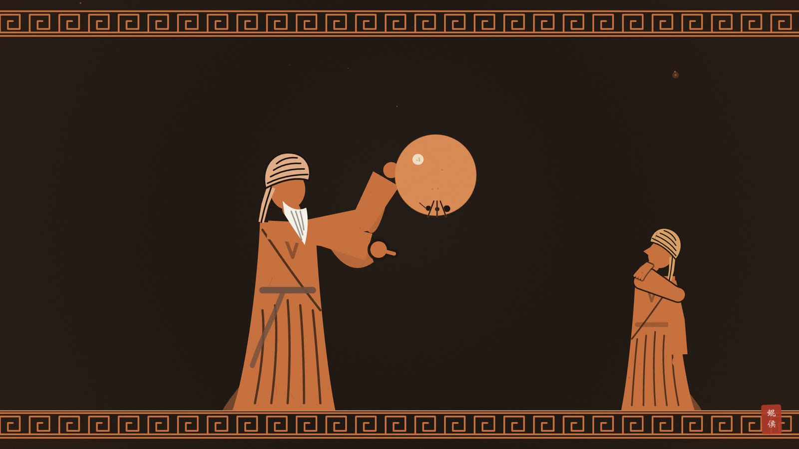
One who limits himself, in learning about this, to what he observes in his own dwelling place only, thinks that they are parallel. But one who adds to his perception by the senses something of sound reasoning, and judges the situation he observes by what lies beyond him in the other dwelling places, ascertains that they lie along the diameters of the sphere, and knows that heads in all places on the earth are towards the high sky and feet towards its low centre, so that each of them claims uprightness for himself and being upside down for the other. When the situation between the people of Ṣīn and the people of al-Andalus, who are at the two ends of habitation, is compared, their feet are opposite each other. A disputant who refuses to believe in high and low as they truly are, if he were to imagine an artificial sphere whose centre is outside the centre of the world, and an ant creeping on its lower part, would faint for fear that it would fall with a fall that we would call flying.
翻译点开
§213. How do the statures of men stand upright on the face of the earth?
第二百一十三问 人的身躯在地面上是怎样直立的?
One who limits himself, in learning about this, to what he observes in his own dwelling place only, thinks that they are parallel. But one who adds to his perception by the senses something of sound reasoning, and judges the situation he observes by what lies beyond him in the other dwelling places, ascertains that they lie along the diameters of the sphere, and knows that heads in all places on the earth are towards the high sky and feet towards its low centre, so that each of them claims uprightness for himself and being upside down for the other. When the situation between the people of Ṣīn and the people of al-Andalus, who are at the two ends of habitation, is compared, their feet are opposite each other. A disputant who refuses to believe in high and low as they truly are, if he were to imagine an artificial sphere whose centre is outside the centre of the world, and an ant creeping on its lower part, would faint for fear that it would fall with a fall that we would call flying.
在认识这件事上,只限于自己住处所见的人,以为它们是互相平行的。但若在感官的知觉之外再加上一些正确的推理,并以自己所见的情形去推断他所在之处以外别的住处的情形,就会确知它们是沿着球的直径排列的,并且知道在地上一切地方,头都朝着高高的天,脚都朝着它低低的中心,所以每个人都自认为直立,而认为别人是倒立的。若把有人居住之地两端的中国人与安达卢斯人的情形相比较,他们的脚是彼此相对的。一个不肯相信真实意义上的高与低的争辩者,若设想一个人造的球,其中心在世界中心之外,有一只蚂蚁在它的下部爬行,他就会因为怕蚂蚁掉下去而晕倒,而那种掉落,我们会称之为飞起。
大意与图解点开
🔎 大意:只看本地,以为人人平行;加上推理便知人都沿地球直径直立,头朝天、脚朝地心,有人居住之地两端的人脚底相对。
📖 术语
| 术语 | 英文原词 | 意思 |
|---|---|---|
| 平行 | parallel | 彼此方向相同 |
| 直径 | diameters | 过球心的直线 |
| 高与低 | high and low | 朝天为高,朝地心为低 |
| 争辩者 | disputant | 不肯信服的人 |
🧭 图解与讲解
这一问讲地圆的一个推论:人站在地上,身体朝什么方向?只看自己住处的人,以为大家都互相平行(图一左)。但若加上推理,用自己所见去推想别处的人,就知道人人都沿着地球的直径站立:头朝高天,脚朝低处的地心(图一右)。
〔图〕人的身躯沿球的直径直立:头都朝天,脚都朝地心,两端的人脚底相对
〔图〕“上下”以地心为准:朝天为高,朝地心为低,处处如此
于是“上”和“下”没有绝对的方向,只有朝天与朝地心之分。每个人都觉得自己正立、别人倒立;有人居住之地东西两端的中国人与安达卢斯人,脚底恰好相对。这正好接上第二百一十问:人居只占四分之一,它的东西两端在经度上相距半周。
最后比鲁尼用一个嘲讽的比方,对付不肯相信“高低”以地心为准的人:若他设想一个人造小球,球心不在世界中心,一只蚂蚁在球的下部爬,他会吓得晕倒,生怕蚂蚁掉下去;而那样的“掉落”,在明白道理的人看来应当叫作“飞起”。意思是:争辩者心里的“下”,并不是真正的下(图二)。
这个道理对占星的意义在于:天球上的“上升”“中天”“下降”,都是相对于观测者的地平说的;地平随地而变,所以同一时刻各地的上升点与宫位都不相同。下一章讲经纬度时就会看到这一点。
📖 术语
| 术语 | 英文原词 | 意思 |
|---|---|---|
| 平行 | parallel | 彼此方向相同 |
| 直径 | diameters | 过球心的直线 |
| 高与低 | high and low | 朝天为高,朝地心为低 |
| 争辩者 | disputant | 不肯信服的人 |
🧭 图解与讲解
这一问讲地圆的一个推论:人站在地上,身体朝什么方向?只看自己住处的人,以为大家都互相平行(图一左)。但若加上推理,用自己所见去推想别处的人,就知道人人都沿着地球的直径站立:头朝高天,脚朝低处的地心(图一右)。
于是“上”和“下”没有绝对的方向,只有朝天与朝地心之分。每个人都觉得自己正立、别人倒立;有人居住之地东西两端的中国人与安达卢斯人,脚底恰好相对。这正好接上第二百一十问:人居只占四分之一,它的东西两端在经度上相距半周。
最后比鲁尼用一个嘲讽的比方,对付不肯相信“高低”以地心为准的人:若他设想一个人造小球,球心不在世界中心,一只蚂蚁在球的下部爬,他会吓得晕倒,生怕蚂蚁掉下去;而那样的“掉落”,在明白道理的人看来应当叫作“飞起”。意思是:争辩者心里的“下”,并不是真正的下(图二)。
这个道理对占星的意义在于:天球上的“上升”“中天”“下降”,都是相对于观测者的地平说的;地平随地而变,所以同一时刻各地的上升点与宫位都不相同。下一章讲经纬度时就会看到这一点。
原文为公有领域古籍;翻译、印象画与图文解读由 AI 辅助生成,鲲侯审校。